Nicholas Carr’s new book, The Shallows: What the Internet Is Doing to Our Brains, examines how our intellectual technologies—the tools we use to find, store, and share information—influence the way that we think, from the map and the clock to the book and the Internet. In this excerpt, Carr looks at the map’s far-reaching effects on the intellectual lives of our ancestors.
A child takes a crayon from a box and scribbles a yellow circle in the corner of a sheet of paper: this is the sun. She takes another crayon and draws a green squiggle through the center of the page: this is the horizon. Cutting through the horizon she draws two brown lines that come together in a jagged peak: this is a mountain. Next to the mountain, she draws a lopsided black rectangle topped by a red triangle: this is her house. The child gets older, goes to school, and in her classroom she traces on a page, from memory, an outline of the shape of her country. She divides it, roughly, into a set of shapes that represent the states. And inside one of the states she draws a five-pointed star to mark the town she lives in. The child grows up. She trains to be a surveyor. She buys a set of fine instruments and uses them to measure the boundaries and contours of a property. With the information, she draws a precise plot of the land, which is then made into a blueprint for others to use.
Our intellectual maturation as individuals can be traced through the way we draw pictures, or maps, of our surroundings. We begin with primitive, literal renderings of the features of the land we see around us, and we advance to ever more accurate, and more abstract, representations of geographic and topographic space. We progress, in other words, from drawing what we see to drawing what we know. Vincent Virga, an expert on cartography affiliated with the Library of Congress, has observed that the stages in the development of our mapmaking skills closely parallel the general stages of childhood cognitive development delineated by the twentieth-century Swiss psychologist Jean Piaget. We progress from the infant’s egocentric, purely sensory perception of the world to the young adult’s more abstract and objective analysis of experience.
“First,” writes Virga, in describing how children’s drawings of maps advance, “perceptions and representational abilities are not matched; only the simplest topographical relationships are presented, without regard for perspective or distances. Then an intellectual ‘realism’ evolves, one that depicts everything known with burgeoning proportional relationships. And finally, a visual ‘realism’ appears, [employing] scientific calculations to achieve it.”
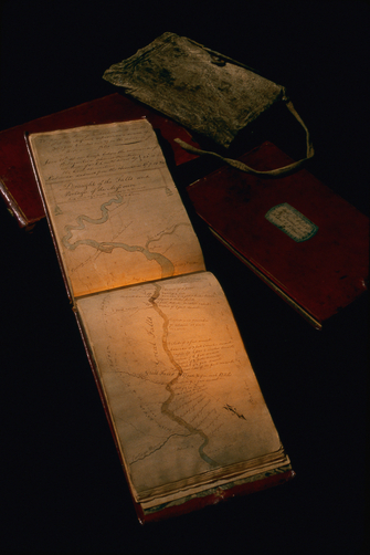
As we go through this process of intellectual maturation, we are also acting out the entire history of mapmaking. Mankind’s first maps, scratched in the dirt with a stick or carved into a stone with another stone, were as rudimentary as the scribbles of toddlers. Eventually the drawings became more realistic, outlining the actual proportions of a space, a space that often extended well beyond what could be seen with the eye. As more time passed, the realism became scientific in both its precision and its abstraction. The mapmaker began to use sophisticated tools like the direction-finding compass and the angle-measuring and to rely on mathematical reckonings and formulas. Eventually, in a further intellectual leap, maps came to be used not only to represent vast regions of the earth or heavens in minute detail, but to express ideas—a plan of battle, an analysis of the spread of an epidemic, a forecast of population growth.
The historical advances in cartography didn’t simply mirror the development of the human mind. They helped propel and guide the very intellectual advances that they documented. The map is a medium that not only stores and transmits information but also embodies a particular mode of seeing and thinking. As mapmaking progressed, the spread of maps also disseminated the mapmaker’s distinctive way of perceiving and making sense of the world. The more frequently and intensively people used maps, the more their minds came to understand reality in the maps’ terms.
The influence of maps went far beyond their practical employment in establishing property boundaries and charting routes. “The use of a reduced, substitute space for that of reality,” explains the cartographic historian Arthur Robinson, “is an impressive act in itself.” But what’s even more impressive is how the map “advanced the evolution of abstract thinking” throughout society. “The combination of the reduction of reality and the construct of an analogical space is an attainment in abstract thinking of a very high order indeed,” writes Robinson, “for it enables one to discover structures that would remain unknown if not mapped.” The technology of the map gave to man a new and more comprehending mind, better able to understand the unseen forces that shape his surroundings and his existence.
Copyright 2010 by Nicholas Carr. Reprinted with permission of W. W. Norton & Company. All rights reserved.
1 Comment
Trackbacks & Pingbacks
Comments are closed.